A partnership to Enhance Polar Security

SEA.AI, has formed a partnership with Latitude Blanche, an expert in polar expeditions, to enhance the artificial intelligence capabilities of their systems in polar environments and polar security. This collaborative venture includes a data acquisition campaign conducted aboard the Polarfront vessel, which will traverse polar waters for several months.

Polarfront: From Meteorological Pioneer to Arctic Expedition Marvel with Latitude Blanche

Polarfront, known as the world’s last meteorological vessel, was constructed in Norway in 1976 and chartered by the Norwegian government for scientific research in the North Atlantic. Specifically, it served the renowned Mike Weather Station located at 66° N, 2° E, widely recognized as the most active weather station globally. In 2017, Latitude Blanche acquired Polarfront and transformed it into an expedition ship, proudly sailing through the icy Arctic waters under the French flag. Today, it gracefully maneuvers amidst icebergs in the breathtaking northern fjords, unveiling the mysteries of these secluded shores. This remarkable experience captivates a select group of adventurers, offering an unforgettable polar expedition while raising awareness about the environmental challenges faced by these extreme and delicate regions and more usually to enhance the polar security.
Photo credit: ©Mickael Peralta / SEA.AI

Harnessing Rare Data to Enhance Polar Security and Protect Marine Life

The polar region is a fascinating but challenging environment, where the protection of endangered marine mammals is crucial, and the presence of icebergs can be hazardous for navigation. To enhance ship safety and preserve cetaceans, SEA.AI and Latitude Blanche have joined forces to collect exceptionally rare and unprecedented data from polar regions. These extraordinary data sets will significantly improve the performance and accuracy of all SEA.AI systems. The ultimate objective is to empower ships to effectively detect and avoid floating objects, including cetaceans and icebergs, with greater efficiency.

The teams of SEA.AI and Latitude Blanche will work together to collect data on the presence of icebergs and cetaceans, as well as meteorological and oceanic conditions. These data will then be used to improve SEA.AI’s floating object detection algorithms, making them more precise and efficient. SEA.AI utilizes advanced AI algorithms and models that have been pre-trained using a vast collection of annotated maritime images. This extensive dataset is essential for teaching the algorithms to accurately identify and classify various types of floating objects. By exposing the algorithms to diverse and high-quality data, they become proficient at recognizing and comprehending different objects and visual patterns. Consequently, a rich and varied database plays a crucial role in enhancing the precision and overall performance of SEA.AI’s AI system.

Photo credit: ©Mickael Peralta / SEA.AI

Navigating New Frontiers: Words from Both Parties

"We are delighted to collaborate with Latitude Blanche to enhance the AI of our systems. Polar waters are a challenging and less frequented environment, but through this collaboration, we will be able to collect valuable data to improve our technology and assist ships in navigating safely." 

"We are pleased to be a partner with SEA.AI for this data acquisition campaign. We believe that this collaboration will lead to the development of innovative solutions to enhance ship and crew safety in polar waters."

The collaboration between SEA.AI and Latitude Blanche highlights the significance of innovation and cooperation in enhancing maritime security and polar safety. The outcomes of this data acquisition campaign will be leveraged to augment SEA.AI’s floating object detection technology, thereby fortifying ship safety in polar waters. This partnership underscores the commitment to continuous improvement and the pursuit of advancements that ensure a safer maritime environment.

Artículos relacionados

Coastal Surveillance Services

Sistemas anti-USV: cómo la IA óptica cubre los puntos ciegos de los sensores tradicionales

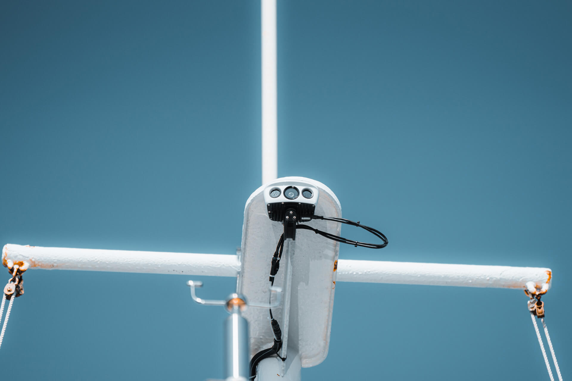
El radar detecta un contacto. El AIS muestra un nombre, si la embarcación decide transmitirlo. Cuando un USV hostil no hace ninguna de las dos cosas, la IA óptica es el único sistema que sigue viéndolo. Esa es la brecha que SEA.AI ha desarrollado para cerrar.

Frank Lattanzi - SEA.AI Sales Manager

SEA.AI amplía su red norteamericana

SEA.AI crece en Norteamérica: nuevo equipo, mejor asistencia y mayor disponibilidad. Estamos reforzando nuestra presencia en Norteamérica con nuevos talentos, un mayor apoyo y un acceso más amplio a nuestros sistemas de seguridad.

Maritime Multi-Object Tracking on SEA.AI App

Seguimiento Multi-Objeto en el Mar: Cómo la IA Identifica Cada Contacto en Superficie

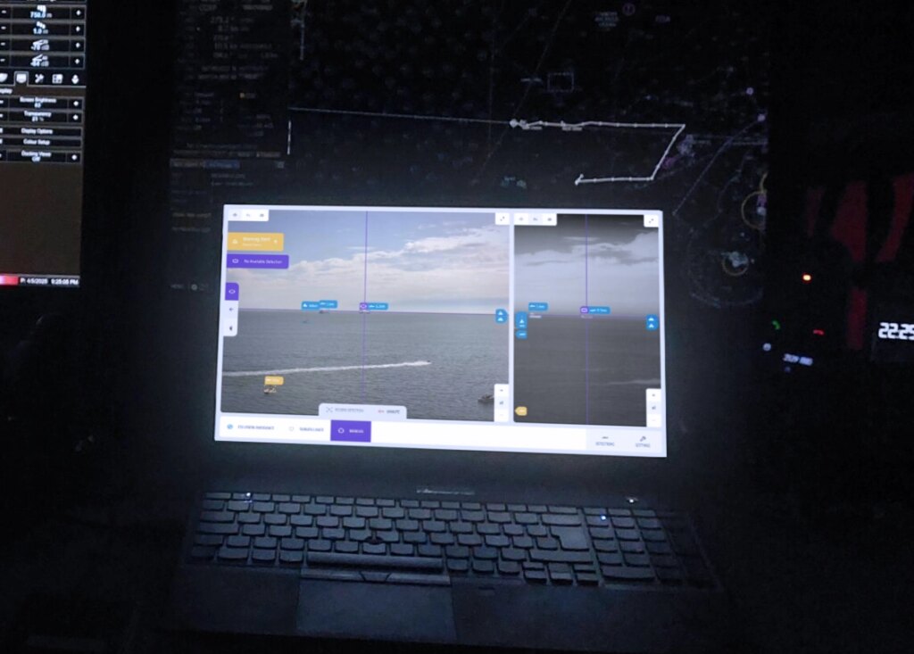
La detección te dice qué hay en el mar. El seguimiento multi-objeto te dice qué es cada contacto, de dónde viene y adónde va, para cada objeto de la escena de forma simultánea. Esa es la diferencia entre una instantánea y la inteligencia operativa.